One of Hokkaido's 14 regions
Shiribeshi後志
Otaru's canal, Yoichi whisky, Niseko snow and the Shakotan coast.
Shiribeshi is a region of western Hokkaido made up of 20 municipalities, from Otaru and Yoichi on the coast to Kutchan and Niseko inland. In winter, Niseko and Kutchan are bases for skiing within sight of Mt. Yotei. In any season, Otaru's canal, stone warehouses and sushi counters make a day trip from Sapporo.
In summer, the Shakotan coast is known for deep-blue water called Shakotan blue. Yoichi adds a whisky distillery and fruit orchards. The coast and the mountains are reached by different routes, so choose one area per day rather than trying to link them all.
🧭 JR links New Chitose Airport and Sapporo with Otaru. For Niseko, choose your hotel first, then a seasonal airport bus or JR with a local transfer. For Cape Kamui, change at Bikuni to the town bus and check whether it serves your stop on your date.
Where is Shiribeshi? Choosing between Otaru, Yoichi, Niseko and Shakotan
Shiribeshi is a western Hokkaido region of 20 municipalities: 1 city, 13 towns and 6 villages, including Otaru, Yoichi, Shakotan, Kutchan, Niseko and Rankoshi. It runs from the Sea of Japan coast inland to ski areas and hot springs, so pick a coastal day trip or a mountain stay first. Hokkaido Government municipality list (Japanese)
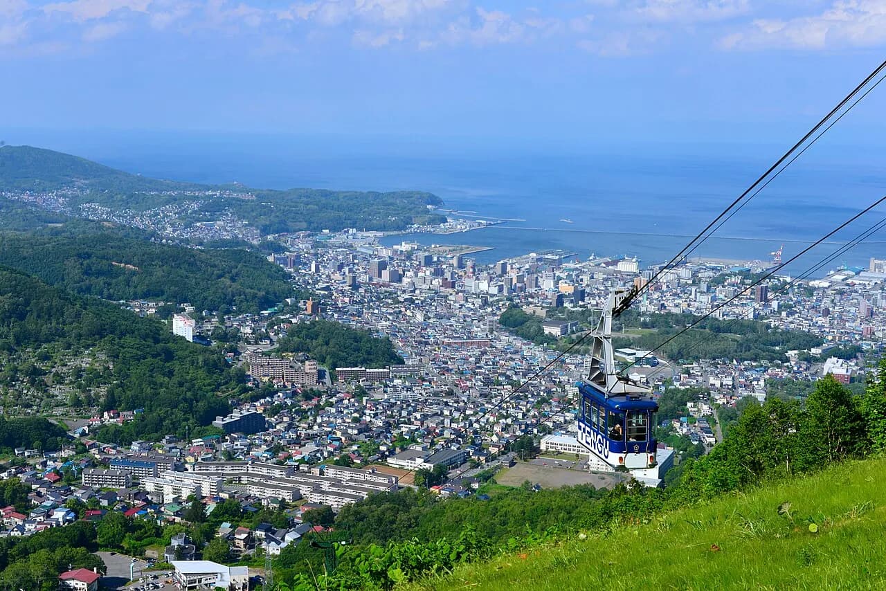
Otaru, Yoichi, Niseko or Shakotan: which trip?
Scroll sideways to see the full table.
| Area and purpose | How to get there | Before booking |
|---|---|---|
| Otaru (town walk and canal) | JR Rapid Airport trains link New Chitose Airport with Otaru via Sapporo; check that your train runs through | The canal is a separate walk from Otaru Station |
| Yoichi (whisky and orchards) | Nikka's Yoichi Distillery: about 5 minutes on foot from JR Yoichi Station, or about 30 minutes by car from Otaru city | Guided production tours need advance booking; the museum and shop are separate, non-reserved areas. Drivers must not drink. Fruit is seasonal |
| Niseko and Kutchan (skiing and onsen) | Choose your hotel or resort first, then compare seasonal airport buses, which need a reservation, with JR via Otaru to Kutchan or Niseko and a local bus or taxi | The area spans Kutchan, Niseko town and Rankoshi, with four resorts not at one station. Arriving at a station is not arriving at your hotel |
| Shakotan (Cape Kamui coast) | Chuo Bus from Otaru Station via Yoichi to Bikuni Terminal, then the Shakotan town bus to Cape Kamui. The town gives about 80 minutes for Otaru Station–Bikuni Terminal only; the transfer and onward ride add time | Bus season, that day's departures and the last return; see below |
Times are the operators' estimates; traffic, weather and winter roads can add time.
Sources: JR Hokkaido airport access; Nikka Yoichi access; Nikka Yoichi visits; Niseko Tourism arrival; Chuo Bus Yoichi route; Shakotan town bus (mostly Japanese).
Otaru · Yoichi · Shakotan · Kutchan · Niseko
Shakotan: check the current Cape Kamui trail closure
Shakotan town says the walking trail from Gate B (the "Nyonin Kinsei" gate) to the tip of Cape Kamui is closed for construction from 5 October 2026 until early April 2027. This is not the whole coast, and in strong wind the gate can close earlier. At the Shimamui Coast the viewpoint remains open, but the stairs down to the beach are closed until early April 2027; do not plan to walk to the shore. Recheck the town's current notice before you go. Shakotan town notices (Japanese) · Cape Kamui trail closure notice
The town bus's currently posted summer timetable runs from 1 April to 30 November 2026, and some trips are reservation-only (yoyaku unko): book those by phone by 17:00 the previous day, as same-day bookings are not accepted. Check which trips you need and settle the last return before leaving Otaru. Shakotan town bus (Japanese)
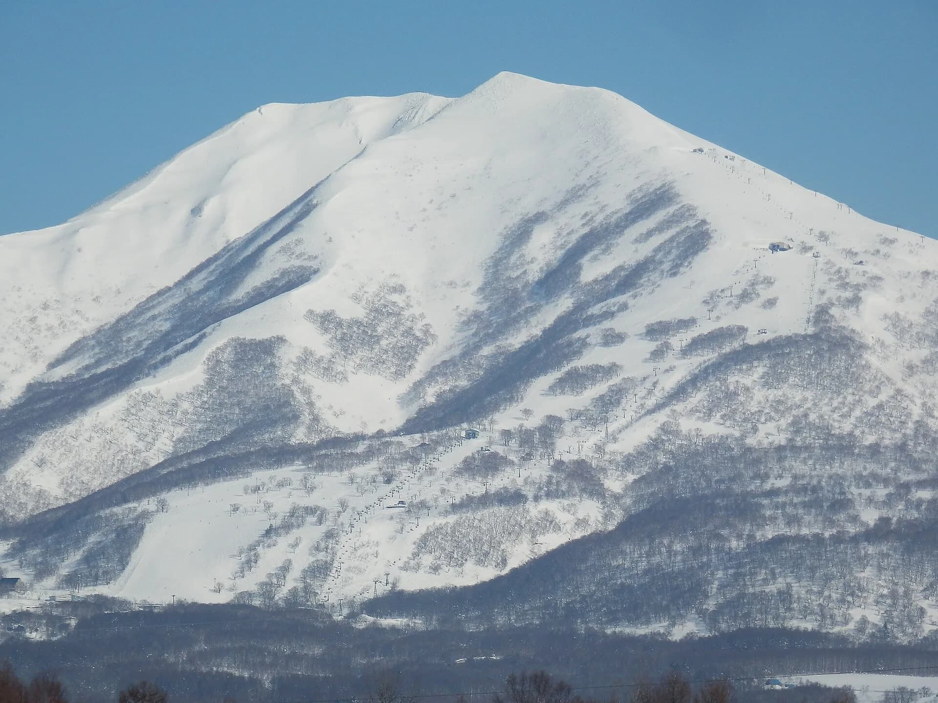
Niseko Annupuri in March 2010. Check current snow and resort opening information before travelling.
Day trip or a stay in Niseko?
From Sapporo, the simplest day trip is either Otaru or Yoichi. Give Shakotan a day of its own, with the return bus settled, or check how to reach any local lodging. For a ski or onsen stay of several days, choose a base first, such as Hirafu, Kutchan town or a resort stop on the Niseko town side, and confirm the hotel transfer or stop before booking. One hotel for the whole region means long coast-to-mountain transfers.
Otaru day trip guide · New Chitose Airport to Niseko · Where to stay in Niseko
Official information checked 15 October 2026. Area and base choices are NLH editorial suggestions; recheck timetables, closures and booking conditions before travelling.
Shiribeshi highlights
Niseko powder
Ski areas within sight of Mt. Yotei. Plan around snow conditions and the lifts and courses that are open.
Otaru canal
Stone warehouses and gas lamps along the canal, with a different mood by day and after dark.
Shakotan blue
Blue sea seen from the capes and coast. Check current trail closures and bus service to your chosen stop before going.
Yoichi whisky & fruit
A town for distillery visits and orchard fruit, which depends on the season.
The 20 towns of Shiribeshi
Click a town to jump to its entry
Otaru小樽市
Canal-side gas lamps, herring-boom mansions and sushi counters an easy day trip from Sapporo — better overnight, after the crowds leave.
Otaru town page →Shimamaki島牧村
Shimamaki is roadless-coast country — its Garo Falls, the 'dragon water', is one of Japan's hundred great waterfalls, deep in beech forest.
Shimamaki town page →Suttsu寿都町
Suttsu harnesses its famous winds for power and slow-cooks shirasu whitebait into the town's signature savory preserve.
Suttsu town page →Kuromatsunai黒松内町
Kuromatsunai marks the northern limit of Japan's beech forests — walk the Utasai grove, then taste the town's celebrated cheese and ham.
Kuromatsunai town page →Rankoshi蘭越町
Rankoshi grows some of Hokkaido's most prized rice in the Shiribetsu valley below Yotei — spring water does the quiet work.
Rankoshi town page →Nisekoニセコ町
The quieter half of the Niseko area — farm-to-table restaurants and Mt. Yotei views without the resort bustle of Hirafu.
Niseko town page →Makkari真狩村
Makkari is Japan's lily-bulb capital, farming sweet yurine in full view of Mt. Yotei's perfect cone.
Makkari town page →Rusutsu留寿都村
Rusutsu is Hokkaido's big playground — a three-mountain ski resort famous for tree runs, plus the island's largest amusement park in summer.
Rusutsu town page →Kimobetsu喜茂別町
Kimobetsu farms asparagus and potatoes under Yotei's south face — and every driver knows it for the fried-potato stand at Nakayama Pass.
Kimobetsu town page →Kyogoku京極町
Kyogoku's Fukidashi Park gushes tens of thousands of tons of Yotei spring water daily — bring bottles like the locals do.
Kyogoku town page →Kutchan倶知安町
Kutchan is the real address of 'Niseko' powder: Grand Hirafu sits here under Mt. Yotei. Some of the world's lightest snow, and the après scene to match.
Kutchan town page →Kyowa共和町
Kyowa grows the Raiden melons and watermelons of summer roadside legend, and holds Shinsen-numa's moody marsh ponds on the Niseko range.
Kyowa town page →Iwanai岩内町
Iwanai claims Japan's first asparagus fields and a surprising Picasso print collection in its clifftop art museum.
Iwanai town page →Tomari泊村
Tomari village keeps herring-boom mansions on a sheltered cove of the Shakotan sea — tiny, salty and proud.
Tomari town page →Kamoenai神恵内村
Kamoenai is a fishing village of a few hundred souls where the Shakotan blue water starts turning wild — sea urchin is the currency of summer.
Kamoenai town page →Shakotan積丹町
Shakotan is the peninsula of 'Shakotan blue' — Cape Kamui's knife-edge trail above impossibly turquoise water, and summer uni bowls to match.
Shakotan town page →Furubira古平町
Furubira is a herring-heritage port under sea-stack cliffs, still landing uni and salmon on the Shakotan coast.
Furubira town page →Niki仁木町
Niki is orchard country — cherries, prunes and grapes ripening into one of Hokkaido's most exciting new wine scenes.
Niki town page →Yoichi余市町
Yoichi built Japan's whisky legend — the coal-fired stills still run — and its fruit farms now feed a booming natural-wine movement.
Yoichi town page →Akaigawa赤井川村
Akaigawa hides an entire village inside a forest caldera — powder skiing at Kiroro on one rim, mountain spring water everywhere else.
Akaigawa town page →
Guides that cover Shiribeshi
Hokkaido in June: Weather, Clothes and a Five-Day Plan
Plan June in Hokkaido with five-city climate normals, rain-ready layers, realistic flower expectations and a four-night route with or without a car.
Read →
Otaru in Winter 2026–27: Snow Light Path, Snow and Day Trips
Otaru in winter: the Otaru Snow Light Path runs February 6–13, 2027, Otaru gets more snow than Sapporo (157 cm in an average January), and it is about 30–35 minutes from Sapporo by rapid train. Weather, snow dates and how to plan a winter day.
Read →
Hokkaido in May: Weather, Clothes and Golden Week Planning
Plan May in Hokkaido with five-city temperatures, layered clothing, Golden Week booking checks and a flexible Sapporo-based route.
Read →
Hokkaido Ski Season 2026–27: Opening Dates Announced So Far
When does the Hokkaido ski season start in 2026–27? Sapporo Kokusai plans to open November 20, Sapporo Teine November 21, and Niseko United and Furano November 28. Closing dates, which resorts have not announced yet, and when snow usually settles.
Read →
Hokkaido Winter Festivals 2027: Dates, Overlaps and How to Combine Them
Hokkaido's 2027 winter festivals with official dates: Lake Shikotsu Ice Festival January 30 – February 23, Sapporo Snow Festival February 4–11, Asahikawa Winter Festival February 6–11 and Otaru Snow Light Path February 6–13. All four overlap from February 6 to 11.
Read →
Hokkaido in Winter Without Skiing: Snow Play, Onsen & Routes
A Hokkaido winter trip without skis: compare snow play at Takino, Sapporo food and indoor days, a Jozankei day-use bath and an optional Asahiyama Zoo extension, with a car-free Sapporo-based 3-night plan, swaps for bad weather and checks before each outing.
Read →
More guides for this region (29)
- Hokkaido in April: Weather, Clothes and a Flexible Route
- Hokkaido in March 2027: Weather, Snow, Spring Skiing and Last Drift Ice
- Hokkaido Trip Budget: Build Your Own Cost Estimate
- Hokkaido with Kids: Bases, Transport and a 5-Day Plan
- Hokkaido Winter Packing List: Sapporo, Otaru and Niseko
- Hokkaido in December 2026: Weather, Snow, Skiing and Christmas Lights
- Hokkaido in February 2027: Snow Festivals, Drift Ice and Weather
- Hokkaido in January 2027: Weather, Powder Snow and Drift Ice
- Hokkaido in November 2026: Weather, Snow and Ski Openings
- Hokkaido Rail Pass 2026: Prices, Area Passes and When It Pays Off
- Hokkaido Winter Weather: Temperatures and Snow by Month, and What to Wear
- Hokkaido in Winter 2026–27: Snow Festivals, Drift Ice and Skiing, Month by Month
- Otaru Food Guide: Sushi, Seafood Bowls & Cafés
- Hokkaido Winter Transport: New Chitose, Sapporo, Otaru and Niseko
- Otaru to Noboribetsu Onsen: Choosing Between Train, Bus and Car
- Getting Around Hokkaido: Car, JR, Buses and IC Cards
- Day Trips from Sapporo: With or Without a Car
- Otaru Day Trip: A Walk from the Canal to Sakaimachi
- Sapporo & Otaru in 3 Days: A Car-Free Itinerary
- New Chitose Airport to Niseko: Bus, Private Transfer, or Train?
- Hokkaido Driving Times: How to Check Routes from Sapporo and New Chitose
- Best Places to Visit in Hokkaido: Cities, Nature and Onsen
- Best Time to Ski Niseko: Months and 2026–27 Season Dates
- 5-Day Hokkaido Road Trip: Otaru, Lake Toya and Hakodate
- 7-Day Hokkaido Itinerary: Sapporo, Furano and Noboribetsu
- 7-Day Hokkaido Winter Itinerary Without a Car: Sapporo, Otaru & Niseko
- Hokkaido Food Guide: Regional Dishes and Where to Try Them
- Where to Stay in Niseko: Hirafu, Kutchan, or the Quiet Side?
- Niseko Travel Guide: The Powder, the Village, and Everything Around It